


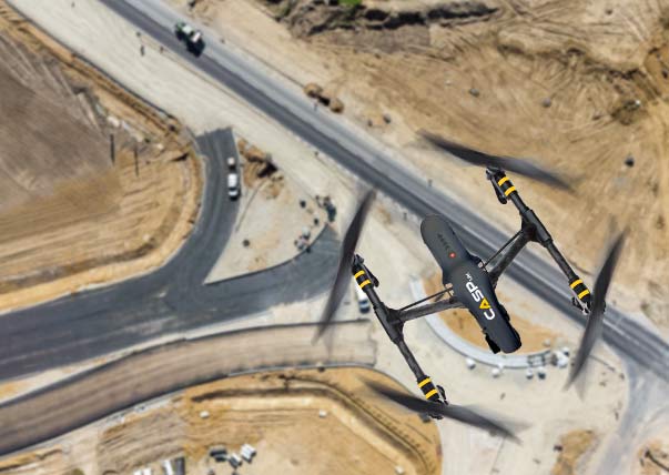
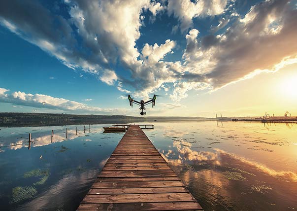
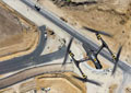
AERIAL SURVEYS
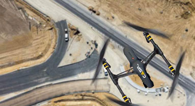
Using the latest in drone/geopositioning technology we can provide a range of surveys, in almost any weather condition, in a fraction of the time.
Detailed geo-referenced orthomosaics, 3D models, Thermal imaging, CAD drawings, Volume calculations, contours and elevations with high accuracy.
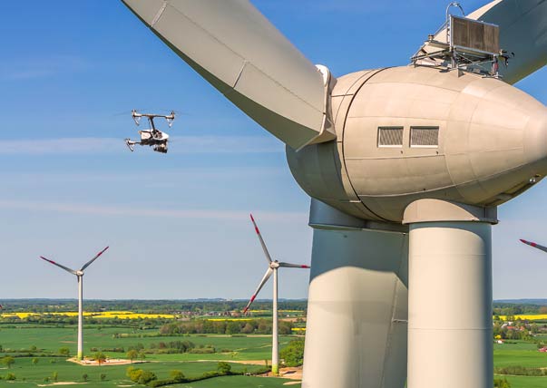
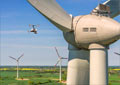
AERIAL INSPECTIONS
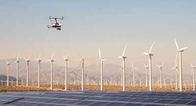
Our fully trained pilots can perform an aerial inspection of almost any area or structure regardless of location or environmental conditions.
Lessen risk and disruption involved in reaching difficult areas for a detailed HD inspection in minutes. Live feeds and Thermal imaging available.

Surveys - Step 1
Initial inspection. Arrange a date and time that suits you. UAV survey completed within 1 day.
Surveys - Step 2
Generate an orthomosaic and scale DTM of the site. RTK ~centimeter accuracy.
Surveys - Step 3
Deliverables: Geo-referenced orthomosaic, Contours & Elevations, Earthwork Volume calculations, CAD drawings, and if you wish a fully realised 3d fly-through or a proposed visualisation of the site.
Post production - Step 4
The survey we provide is produced by an award winning team of visualisation experts. From 3D model terrain alterations and calculations to a full survey breakdown with CAD drawings.

test 1
Precise, Professional & Personal
UAV site surveys
Including Geo-referenced orthomosaics, 3D DEM, DSM, Slope analysis, Elevations, measurements and volumes & CAD.
UAV Aerial inspections
Less risk, less disruption, less cost. No need for extra machinery to view and record hard to reach areas in stunning detail. Thermal imaging is also available.
Aerial Photography and video services
Award winning visual production for your videos. From animations to visualisations to on-brand corporate videos and advertising material.
Surveys
About CASP Surveys
We survey the area using a UAV. From the captured dataset we build a fully textured 3D digital model of the area.
The model is to scale with a high degree of accuracy enabling real world calculations to be carried out. It is fully geo-referenced and from this model we can extract the terrain contour lines, elevations, volume analysis, slope analysis, measurements and existing terrain alteration projections.
It takes less than a day for an average site survey, there is minimal risk and disruption and no extra machinery is required for access.
Inspections
About CASP inspections
CASP inspections are a cost effective way of diagnosing current issues or even planning preventative monitoring and maintenance. Low risk with minimal disruption to site.
Our UAV’s are equipped with 4k cameras for high definition feedback. This can be processed in a matter of hours for analysis, or we can provide a live feed for real time diagnostics. Thermal imaging (FLIR) inspections are also available.
The nature of UAV inspections allows for low cost, high detailed analysis in even the most difficult to reach areas. Without the cost, planning and logistics of a traditional inspection.
photp
About CASP Photography & Video
Our creative team will produce promotional, corporate, event based imagery and visuals of a high commercial standard.
If you have a brand our team of creatives will produce your corporate video on message. Or maybe you want some photography stills for your advertising? – Yep we can do that too and our post processing/video editing services are of the highest standard.
From Estate agents to musicians to movies to visual effects and all marketing communications. Whatever your job requires you can be assured we can handle it from top to bottom.


Providing Aerial surveying from start to completion and professional quality video to the UK. Contact the CASP team now on 07554 349 764 or 07887 957 370
AERIAL SURVEYS
You choose what you need, either a full survey or a part-survey.
Orthomosaic, measurements and volume, CAD, 3D model visualisations and more.
SHOWCASE
Award winning production for visualisations and showcase videos.
From Architects to Developers to Construction to Agents. We can produce your vision.