AERIAL INSPECTIONS
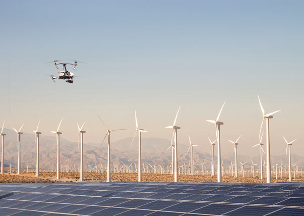
At CASP we conduct many types of aerial inspections; roof and buildings, chimneys, wind turbines, Hard to reach areas, cliff integrity and emergency inspections. Apart from the obvious cost savings involved there are numerous advantages to high quality UAV inspections.
- Our fully trained pilots can perform an aerial inspection of almost any structure/ area regardless of location.
- Using our drones for difficult to access surveys removes the need for costly and time consuming scaffold and rope access personnel which in turn removes the risk to personnel.
- Our aerial inspections and surveys can have massive cost savings eliminating the need for scaffolding and manual inspections, cutting inspection time from days to hours.
- We can provide a real time feed if required
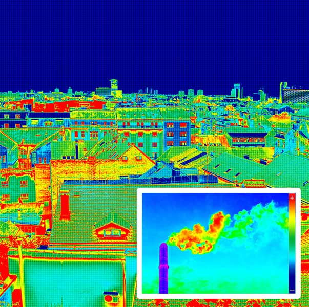
- Thermal imaging can be used for heat based analysis, structure weak spots, escaping gas, solar panel integrity and much more.
INSPECTION PROCESS
Our highly skilled pilots are able to reach critical areas too dangerous for a manual inspection and can cover vast areas in a single flight with all footage available in real time, up to 4K quality.
Ranging from wind turbines to building structures and many more.
Using UAV means we can take the risk out of what could normally be a logistical nightmare. No more cherry pickers, no more scaffolding, no lengthy risk/site/equipment related assessments.
We simply take the UAV into the designated area and our pilots gather a robust dataset. Thermal imaging provides another dimension to aerial inspections and can formulate preventative measures with more regular inspections.
Aerial Survey and Inspection applications:
Agriculture, archaeology, civil engineering, construction, damage assessment, environmental monitoring, flood management, geology, golf courses, heritage, hydrocarbon exploration, insurance, maintenance and accident prevention, mining, pipeline inspection, roofing, building roofing, thermal Imaging, urban planning, utilities, real time analysis video feed, emergency inspections.


WHY THERMAL?
Thermal Imaging detects changes in surface temperature. Using a UAV for this process is the safest and most cost effective way to gather your data with minimal disruption compared to conventional methods. Some of the most common uses of UAV Thermal imaging are;
- Solar panel inspections, preventative and fault detection
- Water leakage
- Measuring temperature: No-contact analysis
- Detect body heat signatures - even under cover
- Visual detection of gas emissions without risk
- Images available in complete dark
- Negate smoke, weather conditions and foliage
- Detect buildings energy loss
- Detect roofing anomalies such as moisture
- Detect electrical anomalies, preventative maintenance
- Agricultural Monitoring - irrigation and plant health
If you need an inspection simply call us on 07554 349 764
We also offer fully realised 3d visualisations, this includes modifying the terrain to your requirements. We will provide all the relevant volume calculations and dimensions regarding the alterations. If required we can then produce full virtual fly-throughs of the existing area or the proposed build.
A full CAD service is available;
- Customized drawing templates
- Fully annotated CAD drawings
- Surface profiles
- Bespoke drawings and calculations
